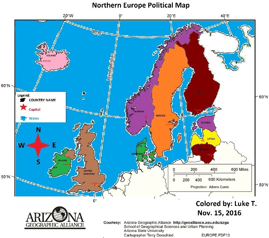
Northern Europe Physical Map
Effects of Physical Features
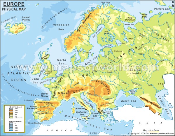
Northern Europe attracts many migrants and tourists with landforms like Scafell Pike (in the United Kingdoms). The region has some flat lands, but is mostly composed of mountains. Since the region is mainly mountainous, agriculture is very rare to see in most areas. Because of this, most people who need to farm will settle near the coasts or rivers. In that case, people will not live in the rural areas. However, dense populations of people still settle in rural flat land areas with very fertile soil.
Northern Europe attracts many migrants and tourists with landforms like Scafell Pike (in the United Kingdoms). The region has some flat lands, but is mostly composed of mountains. Since the region is mainly mountainous, agriculture is very rare to see in most areas. Because of this, most people who need to farm will settle near the coasts or rivers. In that case, people will not live in the rural areas. However, dense populations of people still settle in rural flat land areas with very fertile soil.
Major Landforms in each Country
- Sweden- Scandinavian Mountains, Kolen Mountains, and Mount Kebnekaise
- Denmark- Jutland Peninsula, Mount Mollehoj, and Danish Archipelago
- United Kingdom- Scafell Pike, Grampian Mountains, and Northern Highlands
- Iceland- Glacier Vatnajökull, River Þórisvatn, and Mount Hvannadalshnjúkur
- Ireland- Blackstairs Mountain Range, Mount Ox, and Mount Twelve Pins
- Latvia- River Daugava, River Gauja, and River Lielupe
- Lithuania- Baltic Highlands, Baltic Sea, and Neman river.
- Finland- Artic Circle, Gulf of Bothinia, and Aland Islands
- Estonia- Lake Peipsi. Baltic sea, and Narva river.
- Norway- Bergen Peninsula, Mount Galdhopiggen, and River Glomma
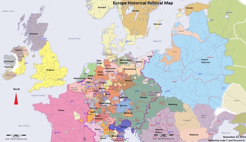
Difference Between Historical and Current Political Maps
The U.K increased in size. This was because Ireland and Scotland joined with England. Denmark gained and lost land, because of World War 2. Germany completely took over Denmark and Norway, because they were conquered during World War 2. Then, they regained their land after Germany was defeated. Southern Ireland separated from the U.K.
The U.K increased in size. This was because Ireland and Scotland joined with England. Denmark gained and lost land, because of World War 2. Germany completely took over Denmark and Norway, because they were conquered during World War 2. Then, they regained their land after Germany was defeated. Southern Ireland separated from the U.K.
